Focussing on and utilising remote sensing technology, German geography student, Claudia Jobst, (25) is on a quest to detect and map tree density in the Skukuza area.
Claudia is doing a six-month internship at the Council for Scientific and Industrial Research (CSIR) in the Earth Observation Group 'ecosystems Earth Observation' of Natural Resources and the Environment, which she started in October this year.
She focuses on remote sensing assessment of nature and ecosystems and is involved with the CSIR's project on remote sensing tree cover mapping on different spatial scales.
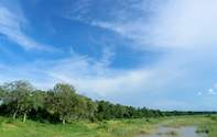
Mapping the density of Kruger's trees can be used as indicator for degradation - not only inside, but also outside the Kruger National Park (KNP). As base-line information Claudia uses the IKONOS satellite system high-resolution data, which represent each metre on the ground as one pixel on the image.
'To detect the trees on the images we extract information of colour and shape properties. In addition we are using data like rainfall, vegetation indices (Normalised Vegetation Index (NDVI)) and vegetation data derived during our field-work in Kruger,' she says.
In November Claudia came to KNP for joint field work with Patrick Dwyer and Marco Vieira. Patrick (24) who is doing his masters through APES (animal plant and environmental science) department (Wits University, Johannesburg) in co-operation with CSIR, focusing on remote sensing based estimations of herbaceous biomass.
Marco (23) is from Wits University, too. He is using new GIS software to try and manage water resources in the Sabie River properly under climate change. 'Our job in the KNP was to collect point data with a GPS for tree coverage in parts of the two selected IKONOS images.
It is necessary to distinguish between tree and grass in the field, because grass and trees look quite similar on these satellite images and are very difficult to differentiate spectrally [on the computer, using a data analysis programme that looks at the wavelengths of the light in the satellite image] and so we want to validate our already produced tree cover map.
'I went into the field, always in the company of an armed guard - just in case we met a lion or so, and took ground-truthing points with the GPS.' She adds: 'Firstly in an area of 100 by 100 metres I mapped all the trees inside of this area and noted their dimensions and the species. With the received information we want to validate the geometric accuracy of our images.
'Secondly I walked zigzag routes and I mapped every 20 steps if there was a tree or not a tree. With this data we want to validate our tree cover map.' After validating the data, the next step will be the up-scaling to coarser resolution images like Landsat (each pixel on the image represents 30m on the ground) or MODIS (250m resolution) as IKONOS images are very expensive and cover only a small area.
Unfortunately the lower resolution Landsat and MODIS images get more and more out of focus and thus lose information on single tree individuals (see image).
But an advantage is that they are more cost effective and cover larger regions. MODIS also delivers daily data, so that changes in tree cover can be mapped with this data very rapidly at low cost. However, the method needs very accurate training on IKONOS to apply to lower resolutions.
Claudia added, 'I'm very happy that I have the opportunity to be involved in such exciting research in Kruger. I hope that I can return, to continue the work here. I would be very glad if I could define a topic for my Diplom thesis (i.e. the German MSc) to come back to South Africa and KNP next year.'
By Claudia Jobst
 This ecology map of Kruger Park describes the location of the various camps in relation to the climate and vegetation. The vegetation determ...